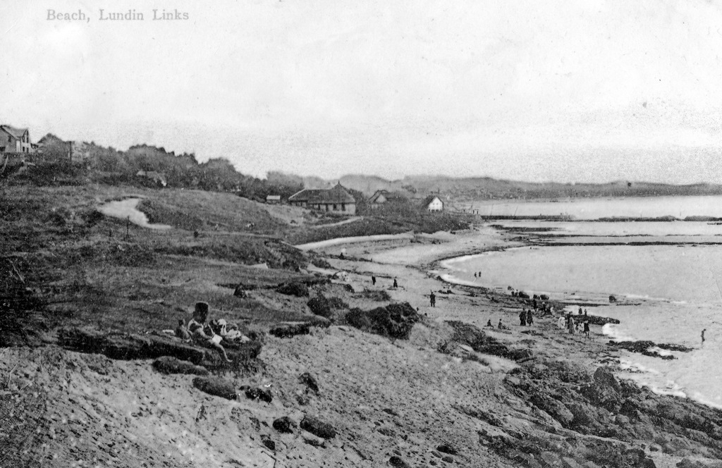
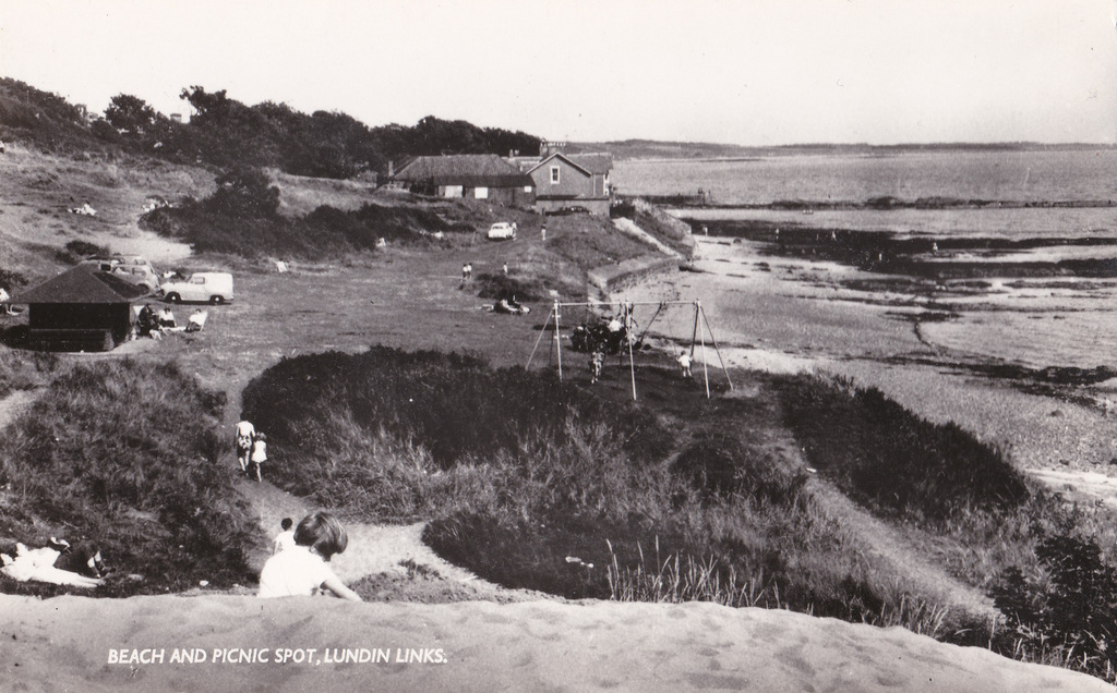
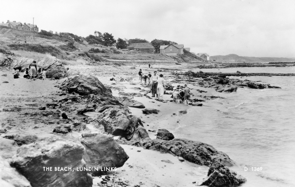
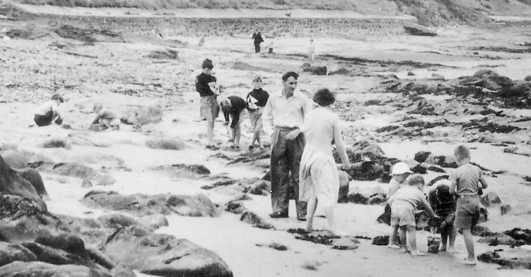
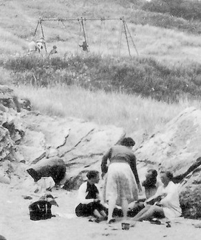
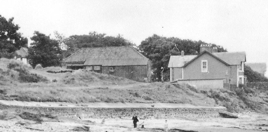
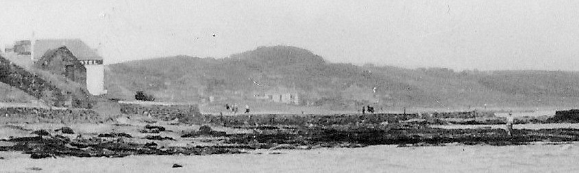
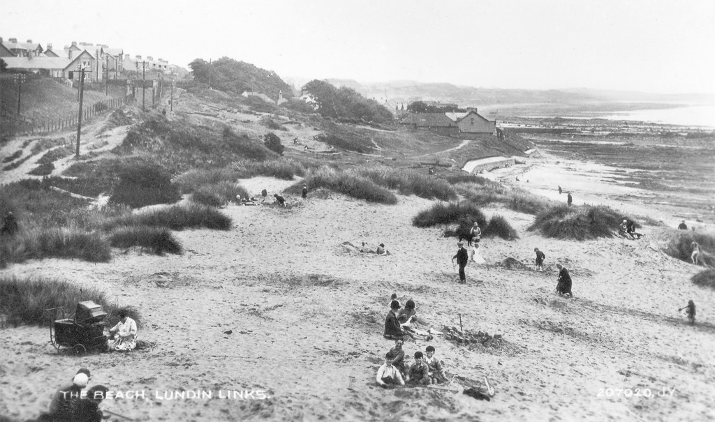
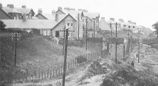
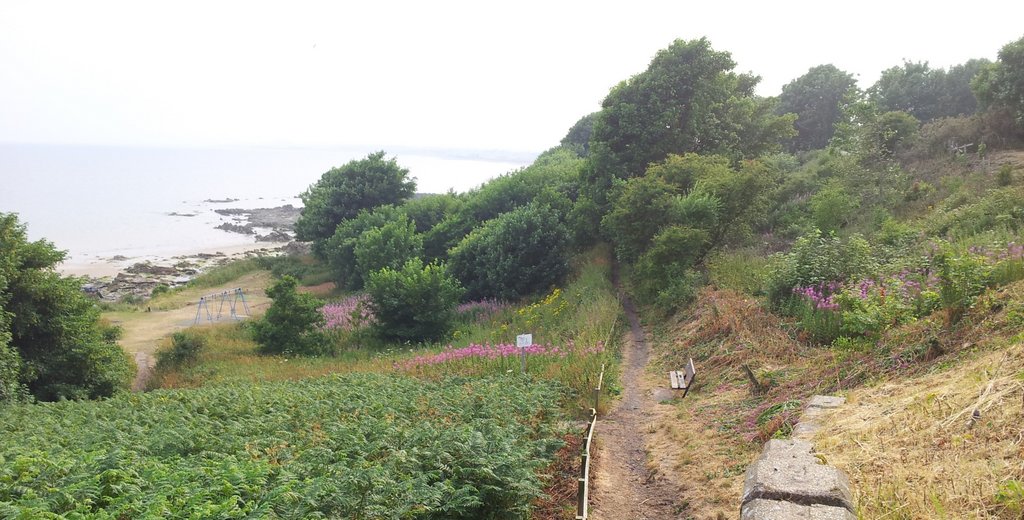
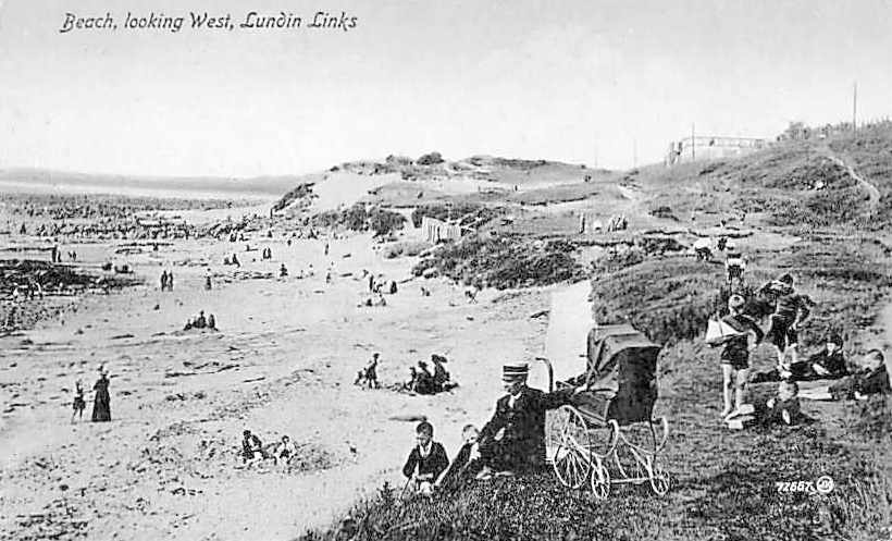
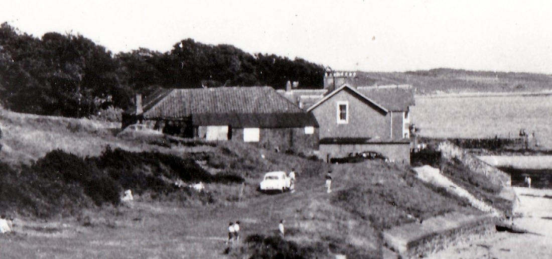
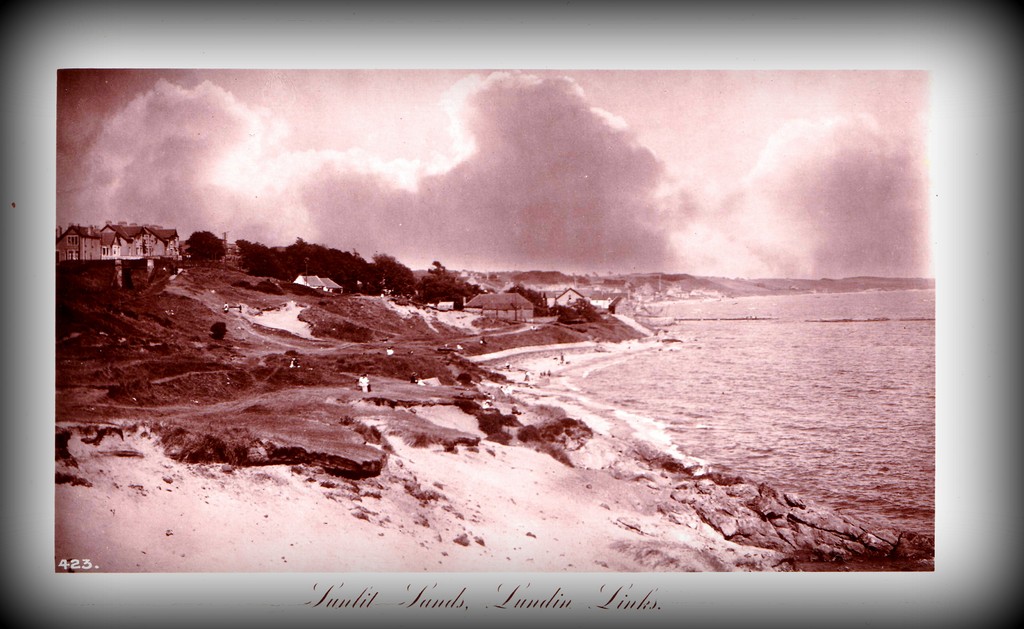
Above are couple of views across Massney Braes looking east - images separated in time by about 60 years. The top postcard dates to around 1905 and shows a rugged coastal area where the natural features provided the fun. Below that is a modern view of a more managed area, complete with shelter, swings and access for vehicles. The braes had been planted with marram grass by the time of the second photograph, in order to stabilise the sand and avoid erosion.
0 Comments
This postcard view of Lundin LInks Beach dates to before 1916 (the year it was posted). There's so much going on in this picture - the five boys and their toy boat in the foreground, the beach huts at the edge of the sand being used by the many beach-goers there that day, and the houses in the distance above the Massney Braes. The Crescent Road houses named Glenairlie (formerly Murree Lodge), Bourtree Brae and Westcliffe/Seacliffe are visible, as are the houses at the junction of Emsdorf Road and Drummochy Road (above the railway bridge), and part of Woodlands Road to the right of that. The detail below shows just how busy the beach could get a century ago.
The beach at Lundin Links is busy in this c1950 view. The number of people in the photograph and the variety in the scenery make it well worth zooming in on some of the detail. Firstly, below are two close-ups on the main groups of beach-goers. Toy boats and buckets and spades provide the entertainment for the children. Rocks provide some shelter for the adults. The swings up on Massney Braes are being well-used too. The first image below shows a joiner's workshop on the left behind the sea wall. This was originally the pan house for the salts works at Drummochy and was demolished in 1967. On the right is Drum Park.
At the foot of the post is some detail of the pier at Lower Largo, with quite a few people walking on it. In the distance are the houses of The Temple and a suggestion of steam rising from a passing train....or perhaps just a scratch on the photograph? This busy beach scene at Lundin Links, looking towards Drummochy, dates from the 1920s. These people are determined to be by the sea in spite of cool weather - plenty of coats, hats and jumpers are in evidence! Popular activities seem to be sandcastle building and digging deep holes. The group of four children in the foreground are enjoying being captured on camera and have some very sturdy looking spades with them. There are some four-legged friends around too. The railway line, that perhaps brought many of these people to Lundin Links, is noticeable in the top left corner, as is the bridge that took the road over the line. This area of the beach has much more vegetation these days.
In the previous post, the discovery of an ancient burial site at Lundin Links beach in 1965 was described. This particular discovery was one of several that had been documented over the years. For example, in 1874 the Courier of 19 June stated that:
"A number of workmen in trenching a piece of waste land to the north of Largo, have turned up human remains. The bones, with skull pointing to the north, mouldered down on exposure to the air. They were encased within a rudely-formed cist of flat stones loosely placed together, and the body seemed to have been interred in a sitting posture. From time to time several similar discoveries have been made in and about the same part of the country." The "similar discoveries" mentioned included various finds made during the construction of the railway in the 1850s, including 15 cists. The advantage of the 1965 excavations was, of course, that scientific progress allowed very detailed analysis of the findings. Plus, the careful cataloguing and storage of the finds made then have allowed subsequent tests to be run on them more recently, as techniques have continued to advance. In brief, the 1965 dig found part of a cemetery which contained both square and round cairns (six in total), five long cists and two more complex burial structures. A 'cairn' is defined as a mound of stones built as a memorial or landmark, while a 'cist' is an ancient coffin or burial chamber. It was concluded that this burial ground had been in use for a period of more than a century. Radiocarbon dating techniques suggested usage between approximately AD 450 and AD 650 (more recent than initially thought). The two complex burial structures were referred to as the 'Dumb-bell Complex' and the 'Horned Cairn Complex'. These structures each contained multiple cists and had clearly been built with great care. A mix of male and female skeletons were found - 22 in all and these were thought to range in age from 18 years old to between 35 and 45. A very full and detailed paper of the findings of the 1965 dig can be viewed at: http://archaeologydataservice.ac.uk/archiveDS/archiveDownload?t=arch-352-1/dissemination/pdf/vol_130/130_585_636.pdf ...this paper contains several photographs and illustrations of the site. I find it very hard to imagine what life might have been like for the people who populated this area at that time but clearly this particular site was important to them. The sheltered bay, the bounty of the sea, nearby fresh water supplies and terrain which is easily travelled over were, and still are, factors which make this area a good place to be. A severe storm in the winter of 1965 blew away tons of sand, exposing skeletons and long cists (ancient coffins) on the beach at Lundin Links. The site, at Masseney Braes, was first noticed by Mr Andrew Horne, proprietor of the garage in Woodielea Road, Lundin Links. Experts were called in and were keen for excavation work to be done before the busy summer season. So, during the Easter holiday period, a dig was carried out by Aberdeen College and Aberdeen University. The East Fife Mail of 21 April 1965 reported that 22 diggers were working at the site and that... "The site proved to be of great interest - more so than the diggers expected. The major discovery was a pair of long cairns linked by a paved and kerbed area, a type of structure that's unusual in the Iron Age." At the time of the dig, the burial site was thought to be between 1,500 and 2,000 years old but there was debate as to whether this was an Iron Age or Bronze Age burial place. Months of analysis of the finds would follow - more on the findings in the next post. With summer on the way - here's a couple of views of Lundin Links beach at Masseney Braes - one in each direction. The top image looks towards Lower Largo on a busy, warm day, probably around 1950. The building on the left hand edge with the tiled roof was the old salt works panhouse (later a joiner's workshop). The older postcard below shows the view from the same section of sea wall but looking towards Leven direction. This early 20th century scene is even busier than the 1950 one. These people may have been a mix of summer visitors, locals and day trippers. This spot was very close to the railway station and the iron bridge in the distance on the right took people over the rail track from the station to the beach. Although the bridge was removed over 40 years ago, some locals still refer to going for a walk 'past the iron bridge'.
The top image shows the panhouse of the former Drummochy Saltworks around the 1950s (when it was being used as a joiner's workshop). It is the darker building to the left of the gable end of Drum Park. The smaller image shows the same building from the other side - probably taken not long before its 1967 demolition. The salt works here began in the early 1740s, by which time there were many long-standing, larger saltworks along the Forth coast. Salt, of course, was a valued commodity for preserving food prior to refrigeration and also had many other uses. Sea water was collected in large iron pans and heated by fires beneath them. As the water evaporated, salt crystals were left behind. The fascinating book, 'Largo - An Illustrated History' by Eric Eunson and John Band contains a chapter on 'Coal and Salt in the Eighteenth Century' which provides much more detail on the salt panning activities at both Drummochy and Viewforth (beyond The Temple). It also includes a super photograph of the panhouse around 1900 with a group of joiners posing outside it, tools in hand. The book notes that the Drummochy saltworks closed permanently in 1787. The panhouse, however, continued to provide a venue for various other activities for another 180 years! Today a private house sits in the site. More to come on the saltworks tomorrow... I love the title of this postcard, the dramatic sky and the brightness of the beach. I'd like to step right into the scene. There must be about 30 people in this image. It would be so interesting to know who they were and find out about their lives. It looks like summer, so many of them are probably visitors. The date of this image is unknown but I'd guess the inter-war period. The railway line is still there. The panhouse of the former Drummochy Saltworks is right in the centre of the image, although by this time it would be used as a joiner's workshop (more on this building in a future post).
In the mid-1930s a proposal had been made to create a bathing pool near Masseney Braes. A 'Largo Bay Bathing Pool Association' had been created and early estimates suggested the work could be done at a reasonable cost. However, as more detailed assessments were made, it became clear that the cost of a pool capable of withstanding the storms to which it could be exposed would be prohibitive. On 18 February 1936 the Evening Telegraph reported that the scheme had definitely been abandoned. |
AboutThis blog is about the history of the villages of Lundin Links, Lower Largo and Upper Largo in Fife, Scotland. Comments and contributions from readers are very welcome!
SearchThere is no in-built search facility on this site. To search for content, go to Google and type your search words followed by "lundin weebly". Categories
All
Archives
April 2024
|